


What are the top 5 Appalachian Footpath Box State Theories? Find out below! (3 clue ideas are given for each state – links are given to more in depth information)
(MW’s Hub page on the AT Box – facts, clues, theories)
Join discussions on the MW Discord – Lots being talked about there
1) Appalachian Footpath Box in Vermont? (Specifically, Little Rock Pond area)

- The trail on the map has been identified to match the green mountain trail –found around the Little Rock Pond area – which the Appalachian trail passes.
- The magnifying glass with tree and words of ‘look & around’ – have been considered to hint to ‘Big Branch Overlook’ – near the trailhead of LRP
- Many of the icons can connect to this area – and the ‘car north’ could hint to the parking lot – which for the LRP trail is the North parking lot
North Carolina
- Car North on the map has been considered to suggest ‘North Carolina’
- The footprints with darker heels – near these words ‘car north’ can suggest ‘Tar Heels’ –a north Carolina reference and providing more support for the state
- The possible ‘wisp of smoke’ icon on the map could hint to the smoky mountains….. which the Trail passes through in North Carolina

New Jersey
- High Point is faintly seen on the map. The Trail travels through High Point State Park in NJ
- 1727 X is seen on the map. This elevation is within that area of the Hight Point State Park
- A faint image of an obelisk like structure is seen at the bottom of the map. This could connect to the monument at High Point.
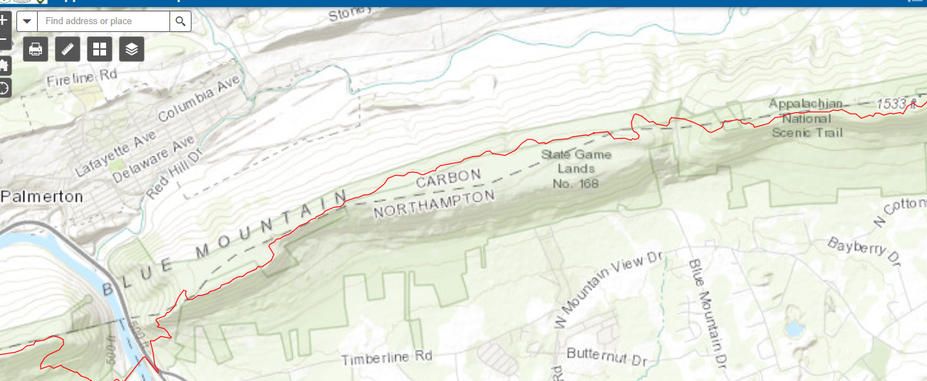
Pennsylvania
- Car North could refer to counties. The AT goes through Carbon and Northampton counties in PA
- This area has a part known as Bear Rocks – the bear next to the rocks – near the X might be a hint to this
- The matched trail – is the Green Mountain Trail (Green is the center of rainbow). This might hint to just that the trail – where the box is hidden – is in the state where center of the AT is – which is in PA
Virginia
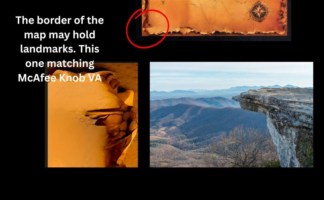
- McAfee knob is a popular lookout on the AT in VA. On the map is a section which – like the trail in Vermont – closely matches this attraction.
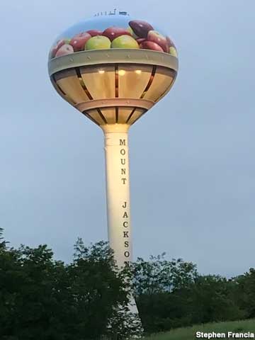
- Rocks are shaped like the numbers 81 by the bear. Interstate 81, which in places in VA, runs near and crosses the AT Trail
- Apple Basket Icon: Anyone who has traveled 81 in VA has probably seen the big Apple basket on the Mount Jackson water tower.
New York
- Begin here with triangle on the map – while with the dog could suggest ‘Springer Mountain in GA – start of the trail’ – it could also be a hint to where the first part of AT began in history – which included Bear Mountain and Harriman state park locations. This by Benton Mckaye
- Bear ‘rocks’ – hint to Bear Mountain
- As mentioned ‘high point’ is seen faintly above the small triangle on the map…. Near where the X is. The other triangle on the map is with begin here….. so the smaller triangle is opposite – end here. Could this be a clue to consider the Opposite of High Point – the Low Point which is in Bear Mountain. The dot or ‘point’ at the base of the end triangle –could support a low point interpretation.